R&D projects
HERMESS is a marine digital innovation consultancy specialised in satellite and in-situ data integration in environmental information services. We have been involved in a number of R&D projects using the newest satellite data and data assimilation techniques in wind and wave modelling. Based on our profound knowledge
Based on our profound knowledge of atmospheric and oceanographic processes, we provide expertise and data related to the marine and coastal environment to support operations, engineering, and management of natural resources.
A selection of R&D projects is given below.
Surface currents from satellite AIS
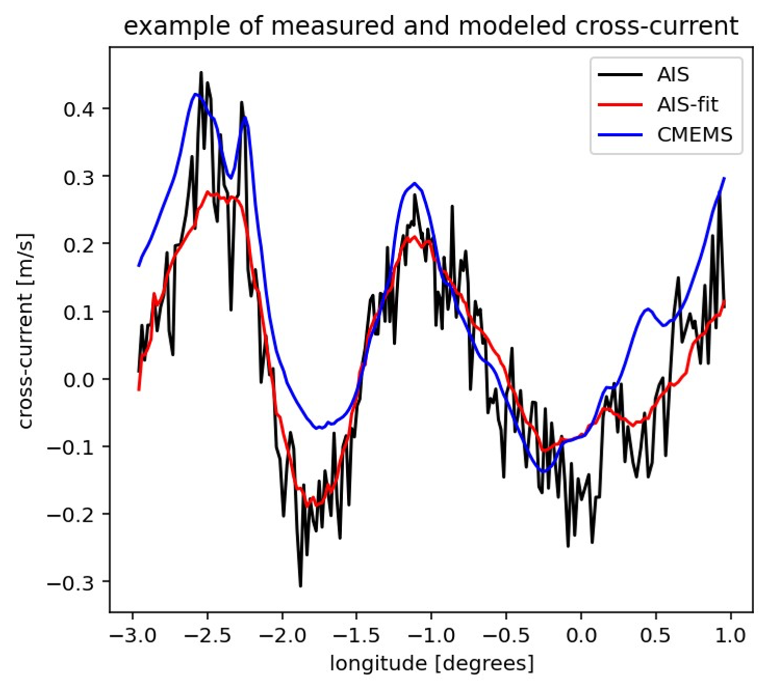
Surface currents are important for shipping activities, to improve efficiency and save fuel and also to better estimate arrival times. In shallow coastal waters tidal currents are generally dominant. Surface currents are routinely forecasted by dedicated models. To adjust these models, current measurements are needed, e.g. from buoys or drifters. Such measurements are scarce in general and absent in busy shipping lanes. As the speed over ground of ships is directly affected by surrounding surface currents, an analysis of speed time series can reveal valuable information about these currents. Nowadays, almost every ship transmits frequently (every 10 seconds) its position and speed, and these AIS signals are collected by land based stations and satellites.
At HERMESS we have developed a method to assess surface currents using satellite AIS data. To obtain reliable information about the currents, the AIS data from many ships are analysed with robust statistical methods. These methods were successfully applied in proof of concept studies to large ocean eddies, tidal areas and rivers.
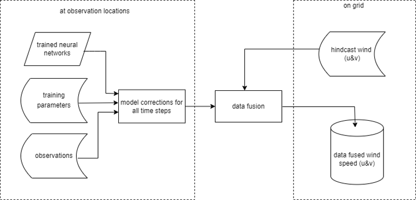
Data fusion
At HERMESS we devloped a new calibration system that significantly improves meteorological data at site level and is easily scalable to facilitate the international operations / ambitions of the different clients.
Measurements are seen as the best available dataset, but continuous measurements are only available for met stations or buoy locations. There are only a limited number of locations available and these are spread irregularly, not giving output at the exact location of interest. Models provide high resolution output, but this is less accurate. To combine the strengths of both datasets, we applied a technique called data fusion.